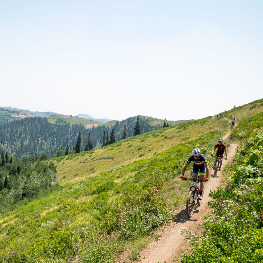
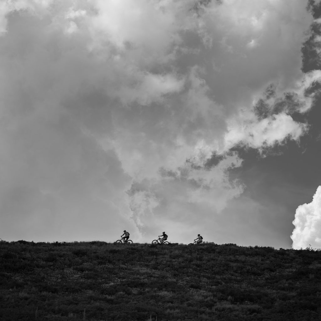
Summer Trails Overview
400 MILES OF SINGLETRACK
Park City trails are open to hiking/trail-running, mountain biking and equestrian trail users. Ranging in altitude from 6,500’ to nearly 10,000’, the trail system spans the whole environmental scale. In a single excursion, trail users can experience everything from high-desert covered in sagebrush, mountain mahogany and rabbit brush to the archetypal high-altitude alpine environment.
Park City has been recognized by the International Mountain Biking Association (IMBA) as the first Gold Level Ride Center in the world and continues to share that status with five other destinations. Both the Mid Mountain trail and the 26-mile, Park City Epic- Armstrong & Pinecone combined with the Wasatch Crest & Mid Mtn, are recognized as IMBA Epic rides.
June – November
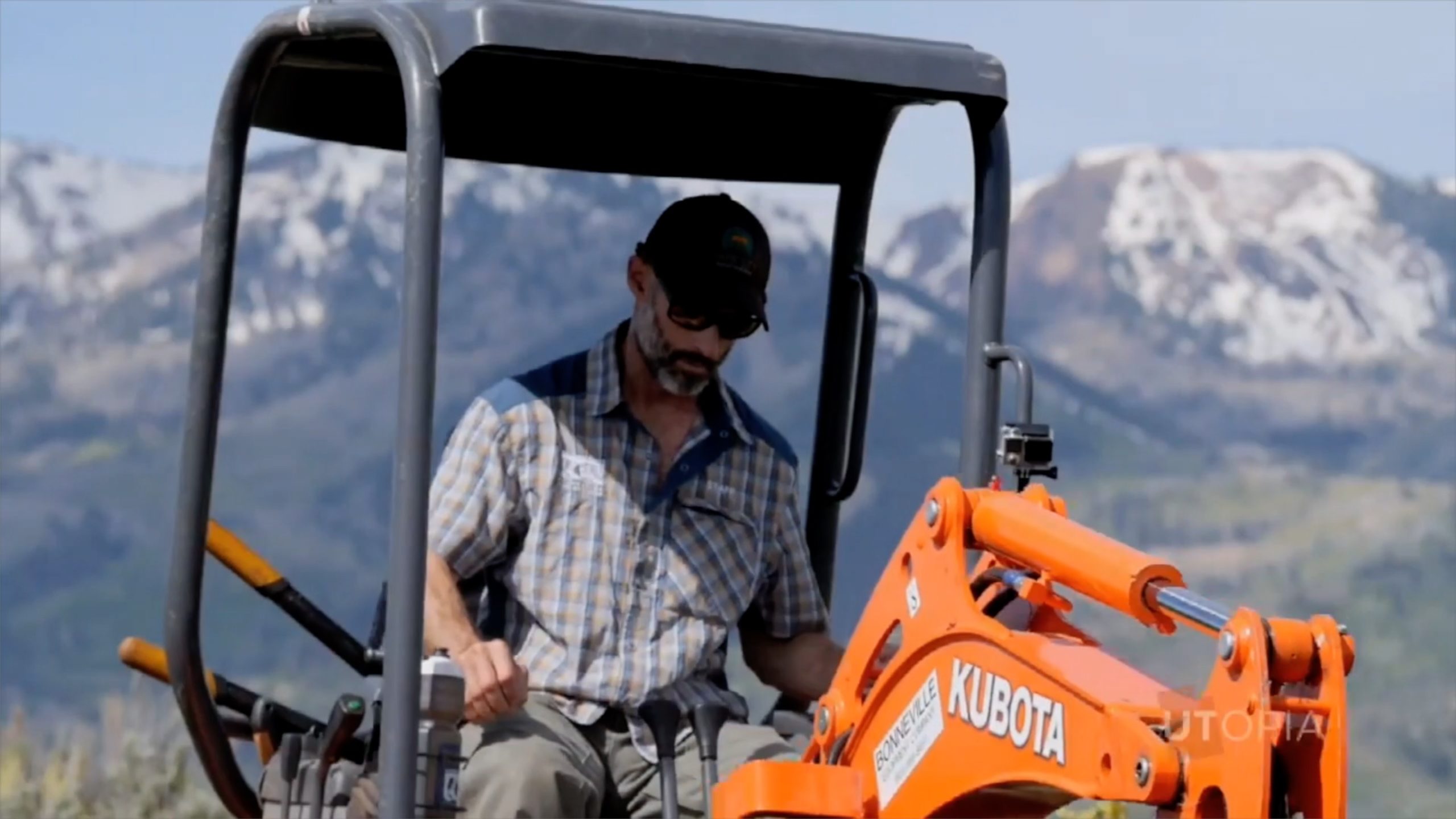
The season for alpine trails typically begins in June and runs through early November. Snowpack and rate of spring melt significantly impact the accessibility of trails above 7,000’. Trail crews must wait until trails are dry before they can begin clearing winter blow-downs and making necessary, post-winter repairs. Trails in the lower-lying areas of Park City, such as Round Valley and Glenwild dry out and can be accessible up to six weeks earlier than on-mountain trails.
Weather
Utah is known for dynamic and severe weather, especially on the Wasatch Back. During summer months, temperatures can vary as much as 40 degrees in a single day. Summer storms, though typically brief, often cause sudden downpours of heavy rain/hail with temperatures plummeting 25+ degrees and are usually accompanied by lightning. Keep an eye on the sky. If thunderheads begin to develop it is wise to get off the mountain quickly.
Recommended Routes
The content in our suggested routes section is provided by Prime Cuts. Hard copies available with your Mountain Trails membership.


Hi there, I’m Rick (and team) with your weekly update
Field Manager
Follow our social media pages for the latest news and trail updates or check here each week.
Happy Friday trail peeps! Your weekend trail update for May 10th-12th...
Well, after a snowy "sprinter" start to the week, it's beginning to feel spring-like once again. We've got a chance of showers and thunderstorms all weekend long, but at least the temps are going to return to the 60's. We'll take it!
Our team has been out and about doing some recon today and surprisingly, despite all the snow, the trail conditions are pretty darn good right now.
90% of the Round Valley trails are good to go. There are still a few pockets of mud on the Hwy 40 side but we're getting close.
New to the "good to go" trail mix is Lost Prospector, Skid Row and Freemason- tacky goodness! The Masonic/Solamere Connector zone is still on the sticky side.
Clark Ranch is green light-go as are the Skyridge area trails. Our team spent the the past few days on the Big Dipper, raking off loose rock and adding drainage where needed. Be sure to give it a spin this weekend.
**Wildlife Alert**
We've had a few reports of the Round Valley coyotes being pretty territorial these past few weeks. Dog owners- keep in mind that springtime is breeding season and the coyotes are very protective of their pups. ALWAYS carry a leash with you and keep your dogs under control AT ALL TIMES. It's up to us to coexist with the native wildlife. www.wildawareutah.org/wildlife/coyotes/
Have a great one out there! #trailreport
Rick & Team MTF

8 CommentsComment on Facebook
Anyone know if Bob’s basin is good to go?
Clark Ranch? 🤷
Awesome update. Is it possible to update on Trailforks?
Areas
With 400 miles of singletrack in Park City, you’ll want to take a moment to get to the know the different areas before you decide where to go.


Get Trail Maps and Trail Guides
We have paper maps as well as Prime Cuts guides for sale all over town (check your local bike shop). Or you may join the MTF and select maps and guides as your membership gift. We also have a variety of interactive map products you can use for free!
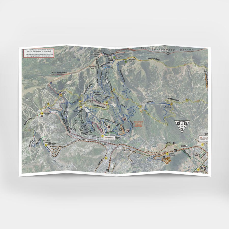
Maps
The most detailed, easiest to read maps can be sent to members with a minimum donation of $30.
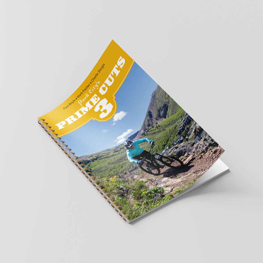
Prime Cuts Guide Book
Prime Cuts 3 is THE guide book to the Park City area’s hiking, biking, mining history, flora and other tips from locals. The full guide will sent to members with a minimum donation of $30.
We also have an abbreviated online version for FREE!
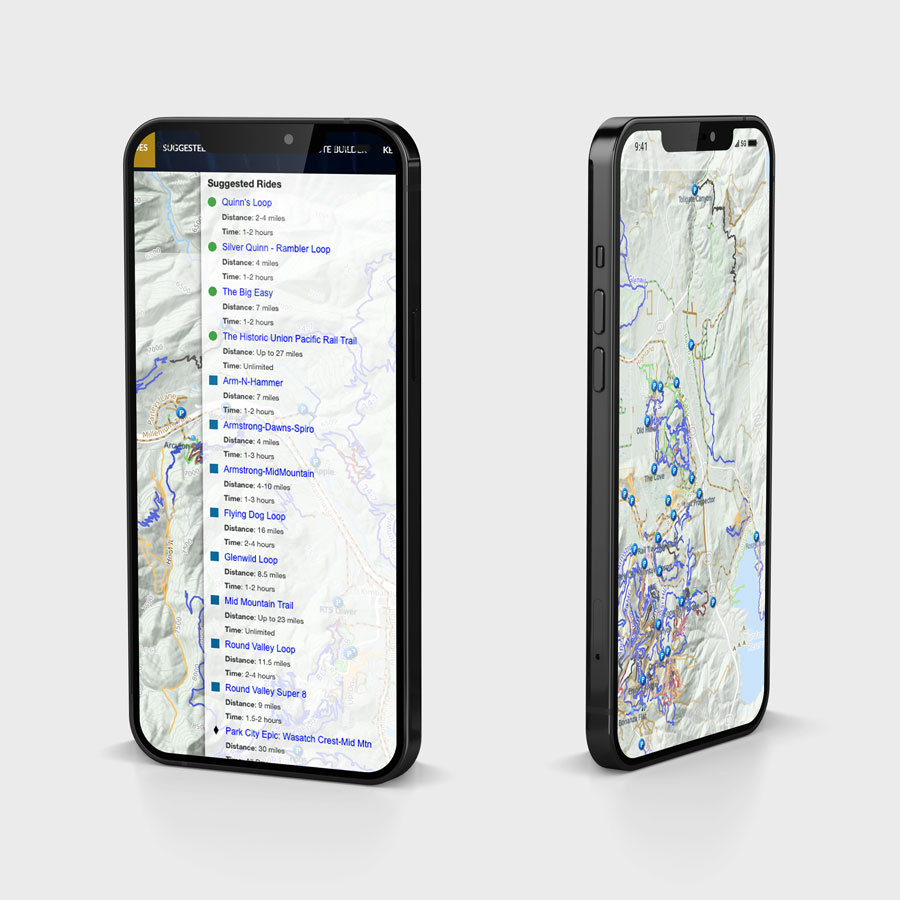
Interactive Maps
Our custom interactive map is available on our website year round for free. It includes suggested routes and a custom route builder.